Gungiajuri Haor: Two Decades of LULC Shifts Mapped by RS-GIS
Project Overview
Duration
July 2023 – June 2024
Institution
Habiganj Agricultural University
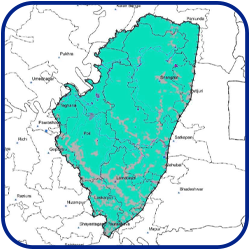
Study Area
Gungiajuri Haor, Habiganj
Supervisor
Iftekhar Ahmed Fagun
Status
Manuscript submitted
Background
Gungiajuri Haor, the largest wetland complex in Habiganj, is rapidly shifting from seasonally flooded rice fields and open water to a patchwork of intensified agriculture and shrinking natural vegetation. Because most research has centred on Bangladesh’s flagship wetlands (e.g., Tanguar Haor), long-term land-cover trends in Gungiajuri remain undocumented.
Using two decades of satellite data and on-site checks, this study fills that gap and provides an evidence base for balancing food security with wetland conservation.
***Detailed results will be shared upon publication.
Objectives
Map cropland, vegetation, and water-body extents for 2000 → 2024
Quantify class-to-class conversions to reveal dominant change pathways
Methodology
Imagery: Landsat 7 & Landsat 8
Field checks: DJI Mavic Air 2
Processing: Google Earth Engine
Classification: Supervised model
Tools: GEE, QGIS, Excel
Significance
First detailed LULC timeline for Gungiajuri Haor, expanding focus beyond well-studied wetlands
Replicable workflow that marries free satellite archives with cloud computing and low-cost drones
Policy leverage for Ramsar-aligned restoration and climate-adaptive land-use plannin
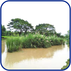
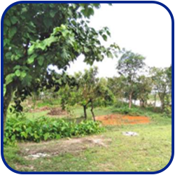
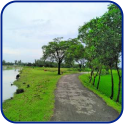
Visuals of the Research Site
Disclaimer
This work represents a research project that is still ongoing. The information presented here is shared solely for academic visibility and discussion; it should not be applied until peer-reviewed publication is complete.